
Newz Desk, Durgapur: The West Burdwan district administration’s decision to engage the National Institute of Technology (NIT), Durgapur, for a comprehensive technical study of vulnerable zones in the Raniganj Coalfields has raised questions over the role and responsibility of the Central Mine Planning and Design Institute (CMPDI), the technical arm of Coal India Limited (CIL).
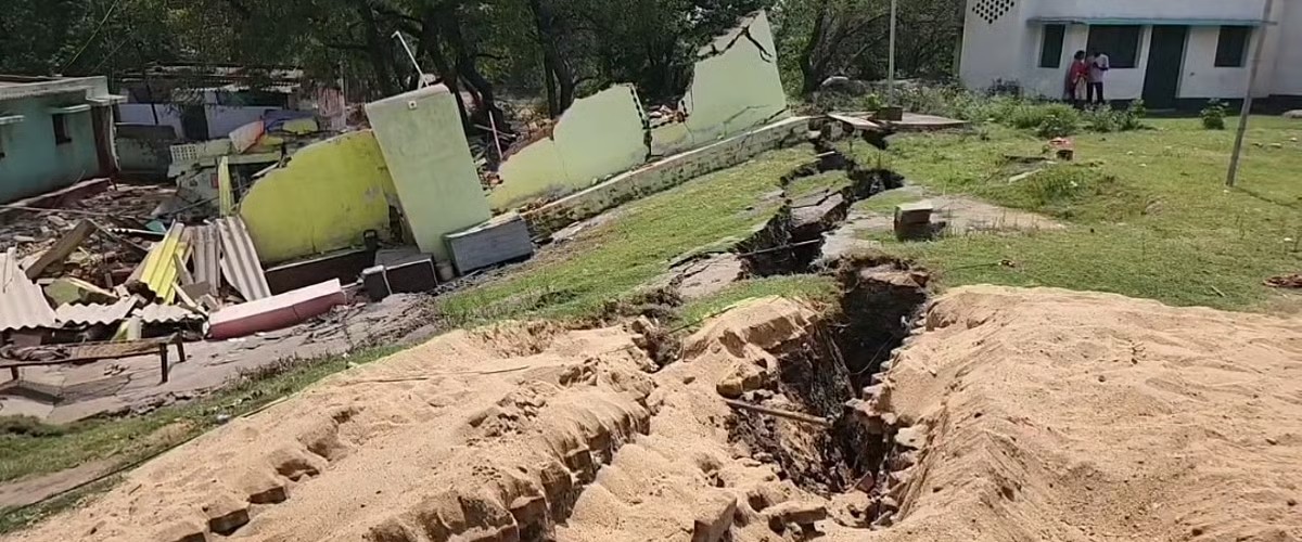
West Burdwan District Magistrate S Ponnamballam has said that the state government is engaging NIT Durgapur to conduct a comprehensive model study to identify technically viable solutions for vulnerable areas affected by ground subsidence and underground mine fires in the Raniganj Coalfields. Six specific locations have reportedly been selected for the pilot study, which is expected to take around a year.
The development raises a fundamental question for the Directorate General of Mines Safety (DGMS): why does the administration now need an academic and research institute to undertake a detailed model study to identify vulnerable zones when CMPDI already functions as CIL’s premier technical consultant for mine planning, exploration and related technical and environmental matters?

CMPDI has long been associated with mine planning, geological investigations, mine design and technical consultancy for the coal sector. Given this technical mandate, questions arise over whether detailed assessments of subsidence-prone areas, underground fire zones and associated risks have already been carried out in the Raniganj Coalfields.
If such assessments exist, the DGMS needs to clarify why the state government has found it necessary to commission a fresh, year-long study involving NIT Durgapur.
More importantly, if six locations have now been identified as requiring detailed scientific investigation, questions also arise over how these sites were identified and whether CMPDI’s existing geological and mine-planning data were used in the process. The issue assumes significance because ground subsidence and abandoned or underground mine fires pose continuing risks to settlements, roads, public infrastructure and residents in several parts of the Raniganj coal belt. Early identification of vulnerable areas is therefore critical for preventing loss of life and property.
The DGMS, as the country’s statutory mine-safety regulator, may also need to clarify whether it has received comprehensive vulnerability maps and risk assessments from the concerned mining agencies for the Raniganj Coalfields. If such mapping has been undertaken earlier, what were its findings, how frequently were the vulnerable zones updated, and how effectively were those findings translated into preventive measures?
Another key question is whether there is a clearly defined institutional division of responsibility between DGMS, CIL, Eastern Coalfields Limited (ECL) and CMPDI for identifying and monitoring subsidence-prone areas, underground fires and other mining-related hazards after mining operations have ceased.
The proposed NIT Durgapur study could potentially provide new scientific inputs through modelling and site-specific analysis. But it also raises the larger question of whether existing technical expertise and data within the coal sector have been sufficient to identify and address the risks in advance.
The DGMS may therefore be asked to clarify:
- What specific subsidence and underground-fire vulnerability studies have been conducted by CMPDI in the Raniganj Coalfields?
- How many vulnerable zones have been officially identified and mapped so far?
- When were these assessments last updated?
- What role has CMPDI played in identifying the six locations selected for the NIT Durgapur pilot study?
- If CMPDI already has technical expertise in mine planning and geological assessment, why was an independent model study by NIT Durgapur considered necessary?
- Have the findings of previous CMPDI studies been submitted to DGMS and the state government?
- What preventive or rehabilitation measures were recommended on the basis of those assessments?
- Who is responsible for periodically reassessing areas where abandoned underground workings may cause future subsidence?
- Will the findings of the NIT Durgapur study be incorporated into a permanent vulnerability map and safety-management plan for the Raniganj Coalfields?
The proposed study could offer valuable scientific solutions. However, the exercise also presents an opportunity for the DGMS and CIL to explain whether the coal sector’s existing technical mechanisms have adequately identified the risks posed by subsidence and underground fires, or whether significant gaps remain in the assessment and monitoring of vulnerable zones.